Cartography and mapping are becoming increasingly ubiquitous in many spheres, including education. Today’s cartography relates to both analogue and digital environments, extending to participatory collaborations with individuals from a variety of knowledge communities, with growing attention to mapping experience, emotions, and Indigenous perspectives.
Multimedia Emergent Mapping for Education (MEME) began as a KMDI project in September 2020, based on conversations between Dr. Stephanie Pyne (Researcher and Sessional Instructor, Faculty of lnformation) and Dr. Glenn Brauen (Human Geography, UTSC) about their overlapping interests in mapping exercises as the basis for community-based, experiential and remote learning. The conversations and this project are extensions of collaborations in community-based, participatory mapping and outreach projects between the two over more than a decade now.
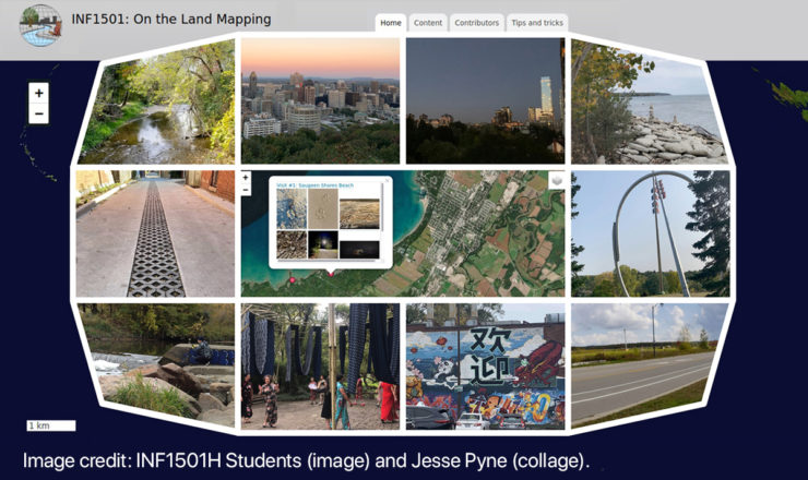
The MEME Project involves the collaborative creation and consideration of online, interactive multimedia maps, their value as community and educational resources, and technical and pedagogical design issues related to their use. The first map created under this project, “On the Land”, emerged through work with and by students in INF1501H (Fall 2020) creating and mapping multimedia and written reflections in response to their surroundings. Adapting lessons and mapping infrastructure established during this course, a second initiative “Mapping Survivors Stories” (based on the series of stories from the Legacy of Hope’s “Where Are the Children Website”) is now emerging through work with and by students in INF1005H and 1006H (Winter 2021) in consultation with Jane Hubbard (Education Director, Legacy of Hope Foundation). For the time being, these course maps are viewable only to registered students, research partners and the class instructor (Dr. Pyne), thereby providing a collaborative forum for sharing reflections and knowledge while allowing students to manage the publication of their contributed content (instructor-only or course-visible). Part of the ongoing research related to these maps involves consulting with the students regarding the future life of the maps to which they have contributed. Illustrating links being forged between pedagogy and research, students have opportunities to contribute in various ways to the MEME Project after course completion.
The MEME Project also has potential to continue in the context of other courses. In particular, Dr. Brauen anticipates collaborative data collection exercises in his own first- and third-year geographic information science courses at UTSC based on the web mapping, content management software being tested and refined in these initial courses. Beyond UTSC and Faculty of Information, the MEME Project is attracting interest from others considering map-based educational strategies within and beyond academia.
Project goals include producing a process and product template for future uses that requires minimal coaching; expanding the epistemological and ontological scope of relevant courses by providing an active, experiential cartographic forum for students to create and present reflections and related content; and contributing to pedagogy relevant to remote and in-person teaching with community-based experiential exercises. Collaborative map creation can contribute to a greater sense of interpersonal class connections including via the sharing of place-based perspectives. We have received positive individual student feedback thus far, with invaluable student input in terms of content and map development.